Isolated Storms Sunday May Bring Damaging Winds, Brief Tornadoes, and Flooding
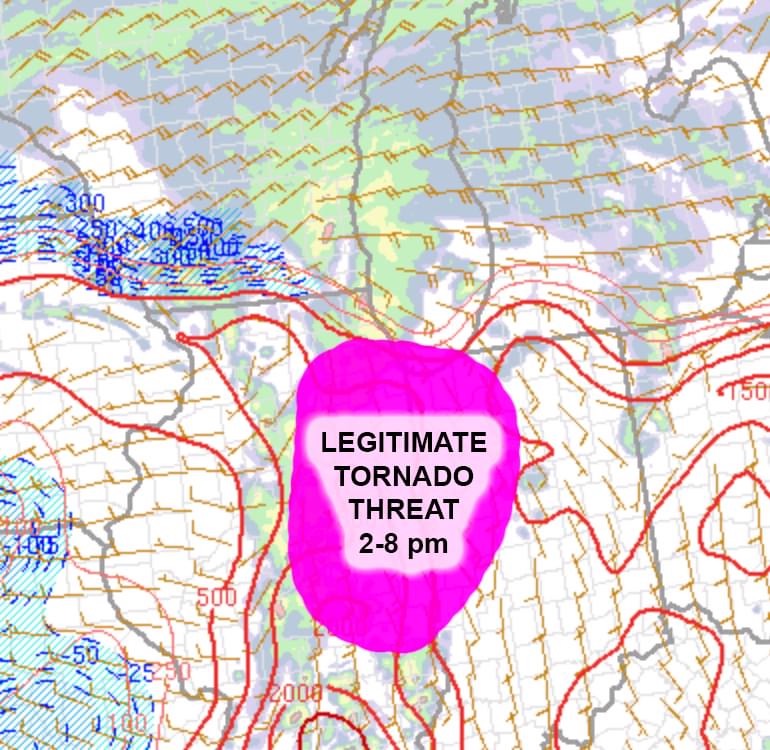
A line of storms moving from IL to IN this afternoon has the potential to produce damaging storms between the hours of 2-9pm today. Isolated storms in this system will be able to produce small bowing segments making strong wind gusts and a chance for a few tornadoes. These storms will most likely be located along the IN- IL state line and through NW Indiana. Strong southern low level winds will enable these few storms to become severe through the evening. Have a good way to receive warnings and be ready for a possible brief tornado if the alerts go off in your area.
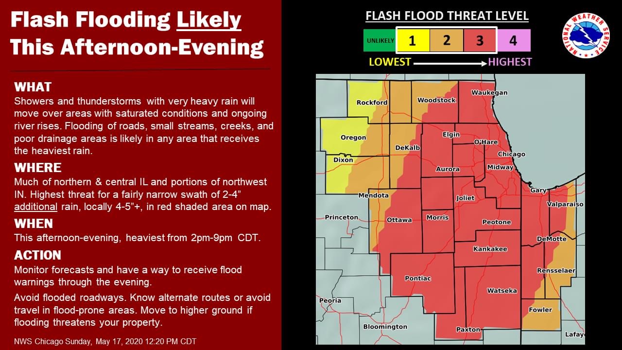
The second concerning threat is that of flooding with another 3-4 inches of rain expected over the area. This additional rain added to the already saturated ground and high water levels will lead to flash flooding across most of the area.
