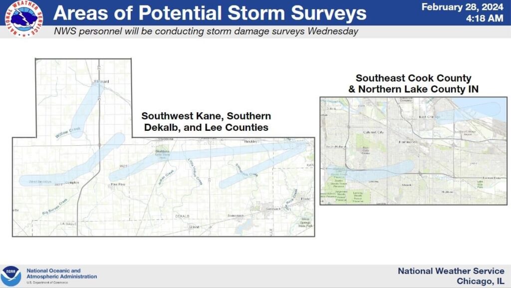
NWS Surveying Possible Tornado Damage Tuesday Night Near EC & Gary
UPDATED – 11 tornadoes confirmed yesterday across the Chicago area. The Gary Tornado was one of those confirmed and rated an EF-1 by the National Weather Service.
There was some minor tree damage found and a few damaged storage buildings surveyed. Estimated wind speed was approximately 70 MPH. A picture of the path is in the comments.
******** Original Article
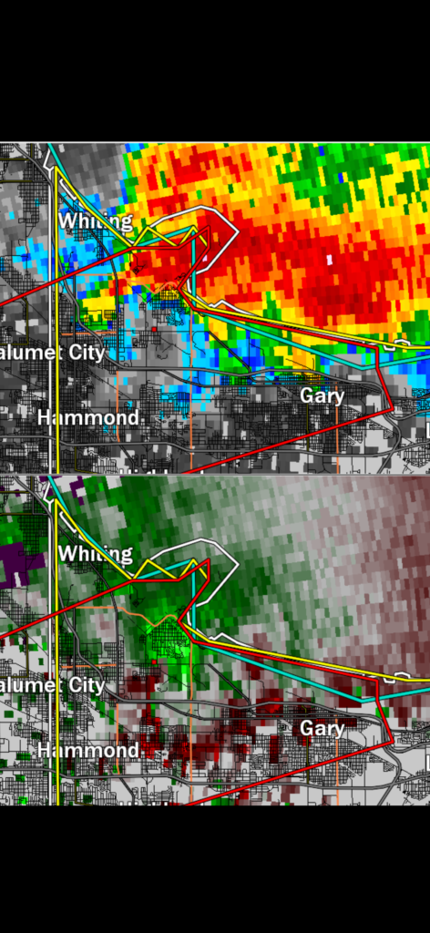
The Chicago National Weather Service is working to confirm a possible tornado shortly after 9 PM, Tuesday, in a path stretching from Lansing to Hammond then into East Chicago to the Gary Airport section of Lake County.
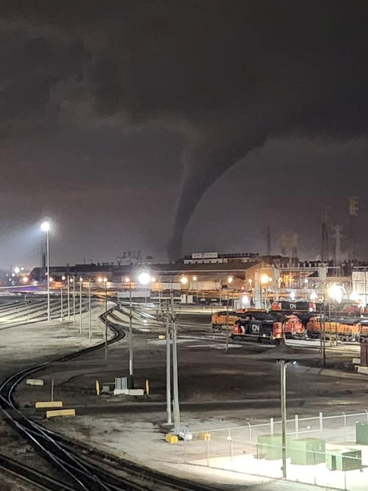
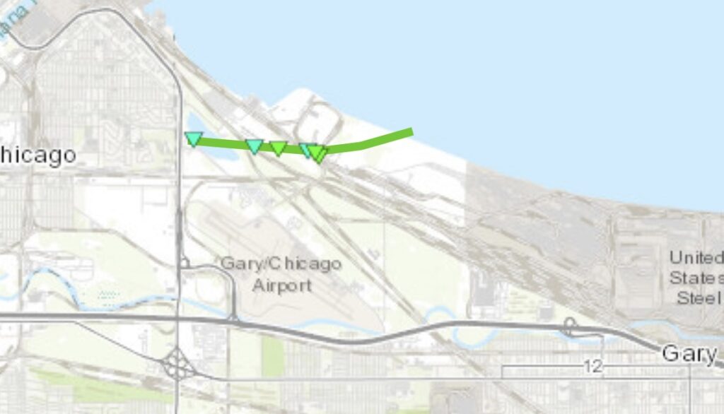
Region News was live under the rotation near 174th & Hohman in Hammond as a tornado warning was prompted due to rotation spotted on radar. Circulation from an obvious mesocyclone was seen on the video before numerous videos showed a tornado touching down just north of the Gary Airport between the mills. The tornado was approximately on land for about 1000 yards before turning into a waterspout over Lake Michigan.
Power outages and downed trees were reported in Hammond and East Chicago along with a few NIPSCO poles bent over near the mills and lake.