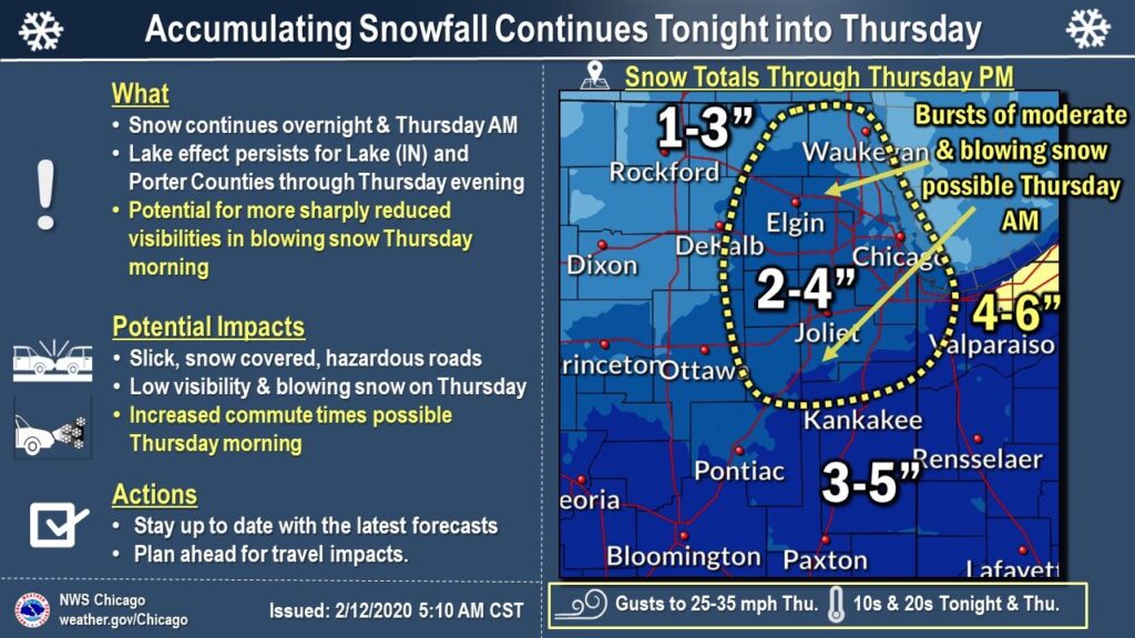
Snow Set To Hit Region Today Followed By Coldest Temps Of The Year
Accumulating snow is expected Wednesday afternoon into Thursday, The National Weather Service said Wednesday. Snowfall rates will generally be light to occasionally moderate. A period of heavier rates is possible at onset of the snow Wednesday afternoon and will continue into Wednesday evening, primarily south of I-80. On Thursday as a much colder air mass moves into the region, lake enhancement snow could add to totals in portions of northwest Indiana and possibly parts of northeast Illinois as well. Gusty north-northwest winds could result in blowing snow issues in open areas. The snow will taper off for most areas by or during Thursday afternoon, but then lake effect snow showers will likely continue into Thursday evening, possibly including portions of Lake and Porter counties. Be prepared for potential travel impacts, including during the Wednesday evening and Thursday commutes for rush hours.
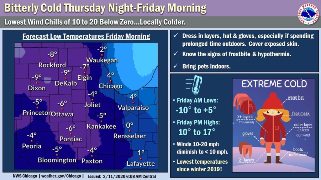
The lowest temperatures since winter 2019 are likely, including a late first sub-zero reading of the season for many locations.
Breezy northwest winds Thursday evening will diminish to less than 10 mph by early Friday, with wind chill values bottoming out at about 10 to 20 below zero. Wind chills locally colder than 20 below are possible in portions of northern Illinois. Temperatures will only rise into the teens on Friday afternoon, though winds will be light under sunny skies.