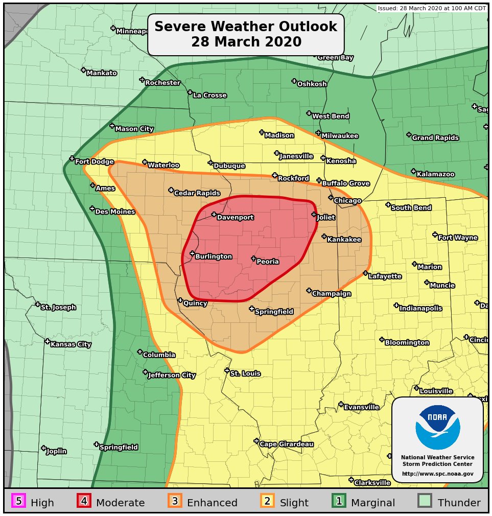
SEVERE WEATHER ALERT FOR SATURDAY
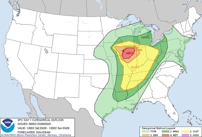
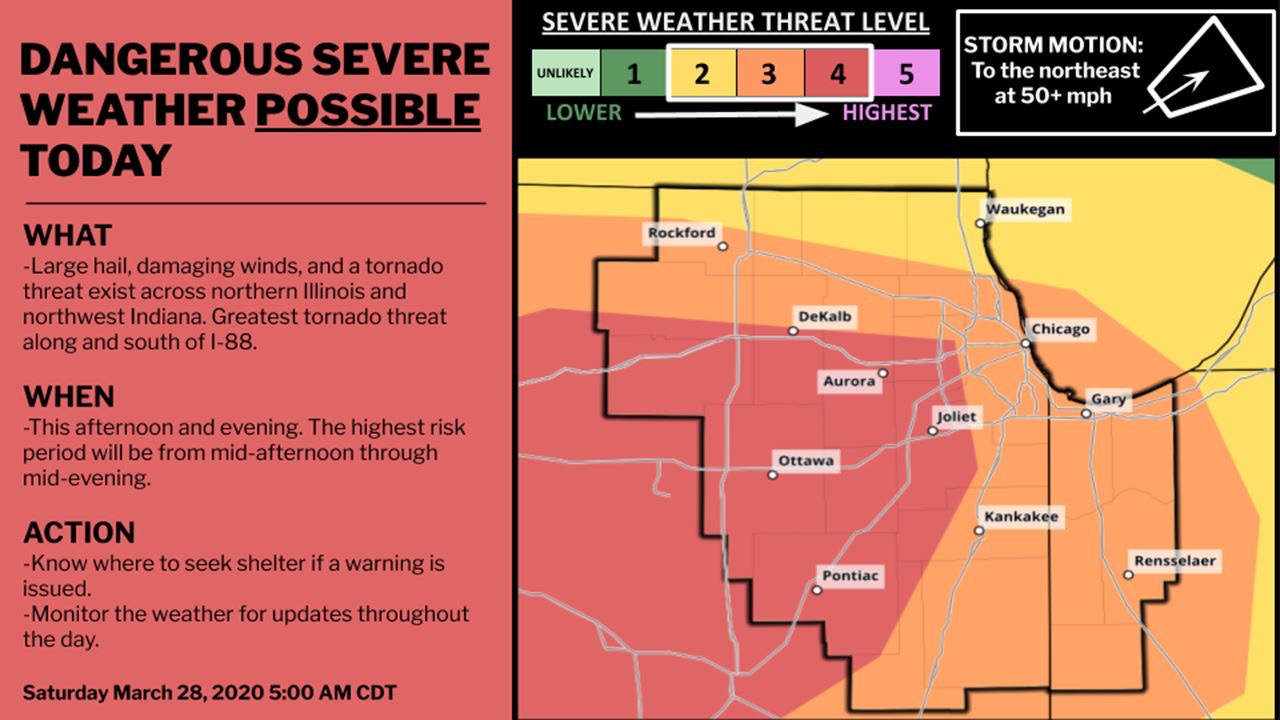
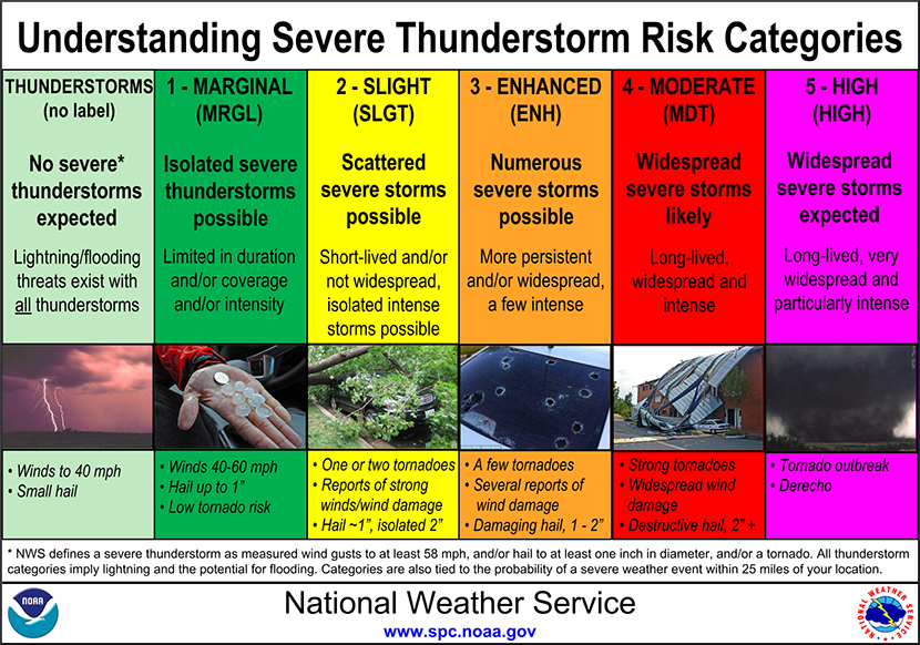
There is a significant risk of severe thunderstorms this afternoon and evening according to a NWS briefing today, with the potential for very large hail and tornadoes.
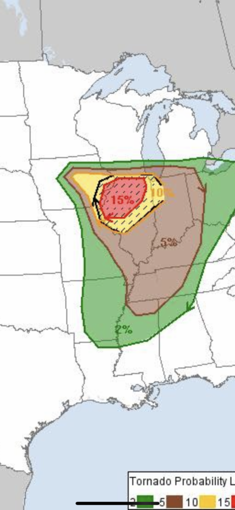
While the threat of severe weather will exist across the entire outlook area, it appears that the greatest threat for tornadoes will be along and south of the Interstate 88 corridor, including the Dixon, Rochelle, Dekalb, Peru, Pontiac, Morris and Kankakee. Individual thunderstorm movement will be rapidly to the northeast.
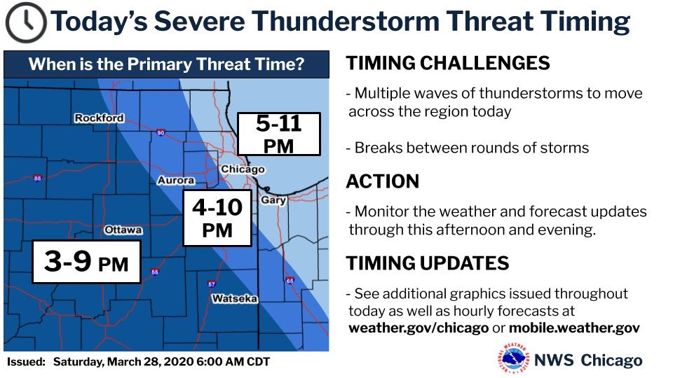
The severe weather threat will end from west to east this evening.
In history on this day March 28, 1920 was the tornado outbreak Palm Sunday. One of the deadliest days of weather in US history. Thinking as of now seems to match up with ingredients and almost similar locations. 37 tornadoes ripped across multiple states killing 380 and injuring 1215. Millions in damages. Take all warnings and watches serious today if they go off in your local area.