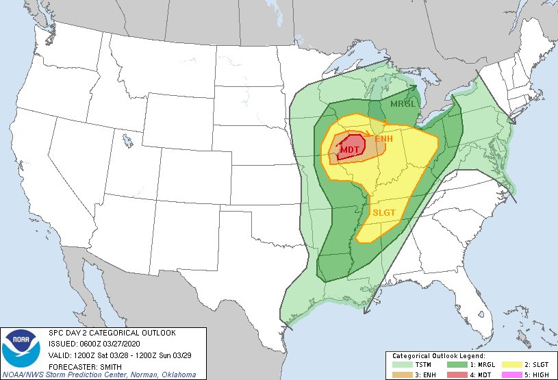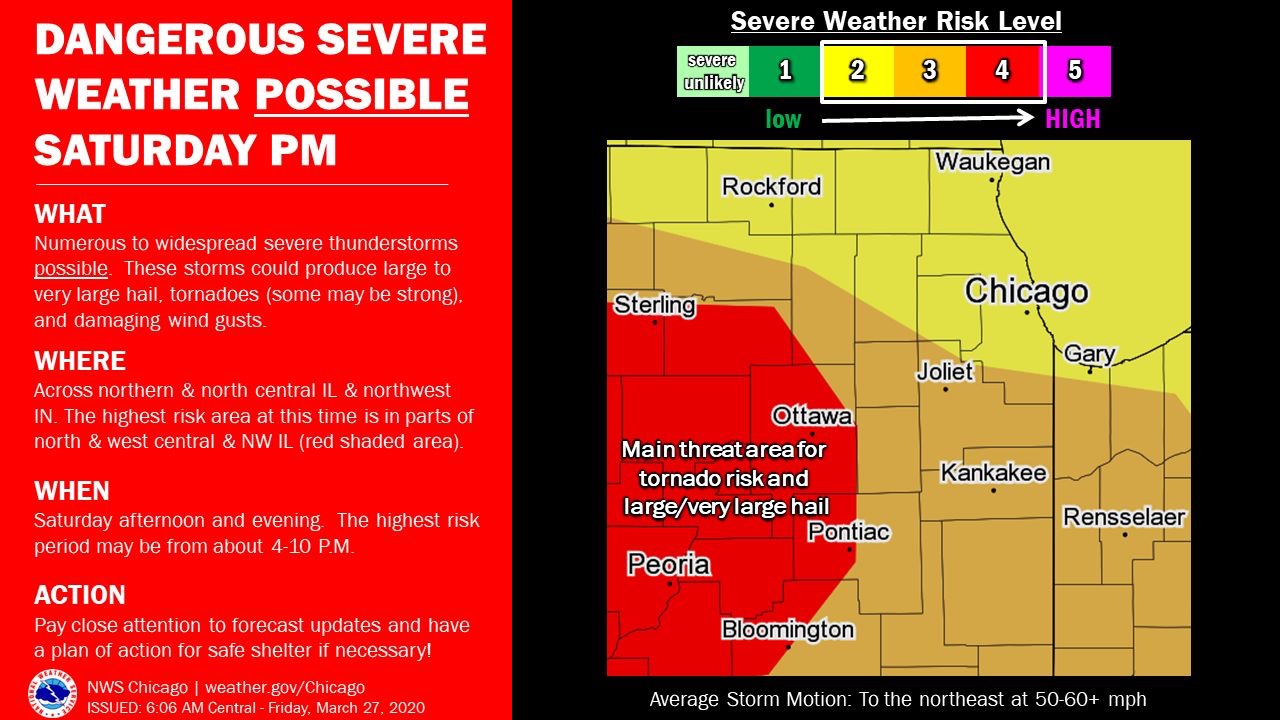
Severe Weather Threat Building For Saturday
A powerful storm system will impact the area on Saturday with multiple rounds of thunderstorms, according to NWS Chicago. Concern continues to increase for the potential of dangerous fast-moving severe storms during the afternoon and evening for portions of the area. All severe hazards will be possible, including large to very large hail, tornadoes (some may be strong), and damaging wind gusts.
Morning showers and thunderstorms may continue into the early-mid afternoon north of I-80, with minimal if any severe risk. As a cold front approaches later in the day, numerous to widespread severe thunderstorms will be possible into the evening. While severe weather is possible area wide, at this time, the main threat area is considered to be in parts of north central, west central and northwest Illinois, roughly in and near the red shaded area on the map. Should severe storms occur, the highest risk period is expected to be from about 4pm to 10pm.
Note that there is still some uncertainty, so it’s important to pay close attention to the latest forecast updates. Have a plan of action for safe shelter if necessary.
PC: weather.gov/Chicago
Mobile: http://mobile.weather.gov
Region News we will have the Storm Tracker out and will broadcast LIVE if necessary of any major events occurring. Links will be provided if that occurs from SVLMedia LLC.