20 Foot Waves & Lake Effect Snow Coming With The Cold Air
Two Weather Threats To Hit Parts Of NWI To Start The Week
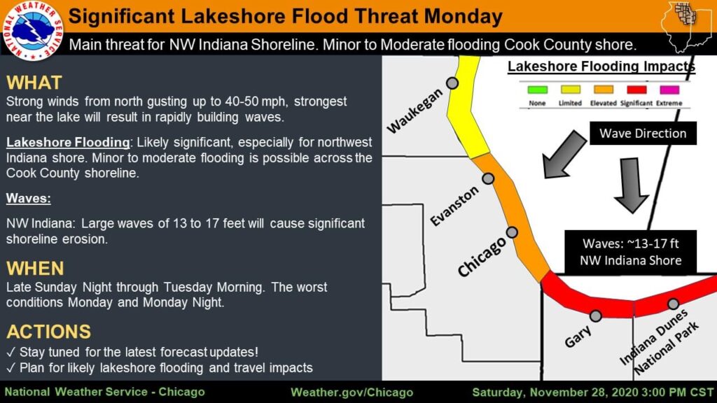
Significant lakeshore flooding is expected across the NW Indiana shoreline starting late Sunday Night & through Tuesday AM. As the cold front pushes in for the week it will be kicking up some monster waves. Significant shoreline erosion is expected and lakeshore flooding to prone areas. Waves are expected to be 13-17 feet with occasional 22 foot waves. That combined with high lake levels is a combo for a shoreline disaster. Minor to moderate lakeshore flooding is possible across the Cook County shoreline as well, with the worst conditions Monday-Monday night.
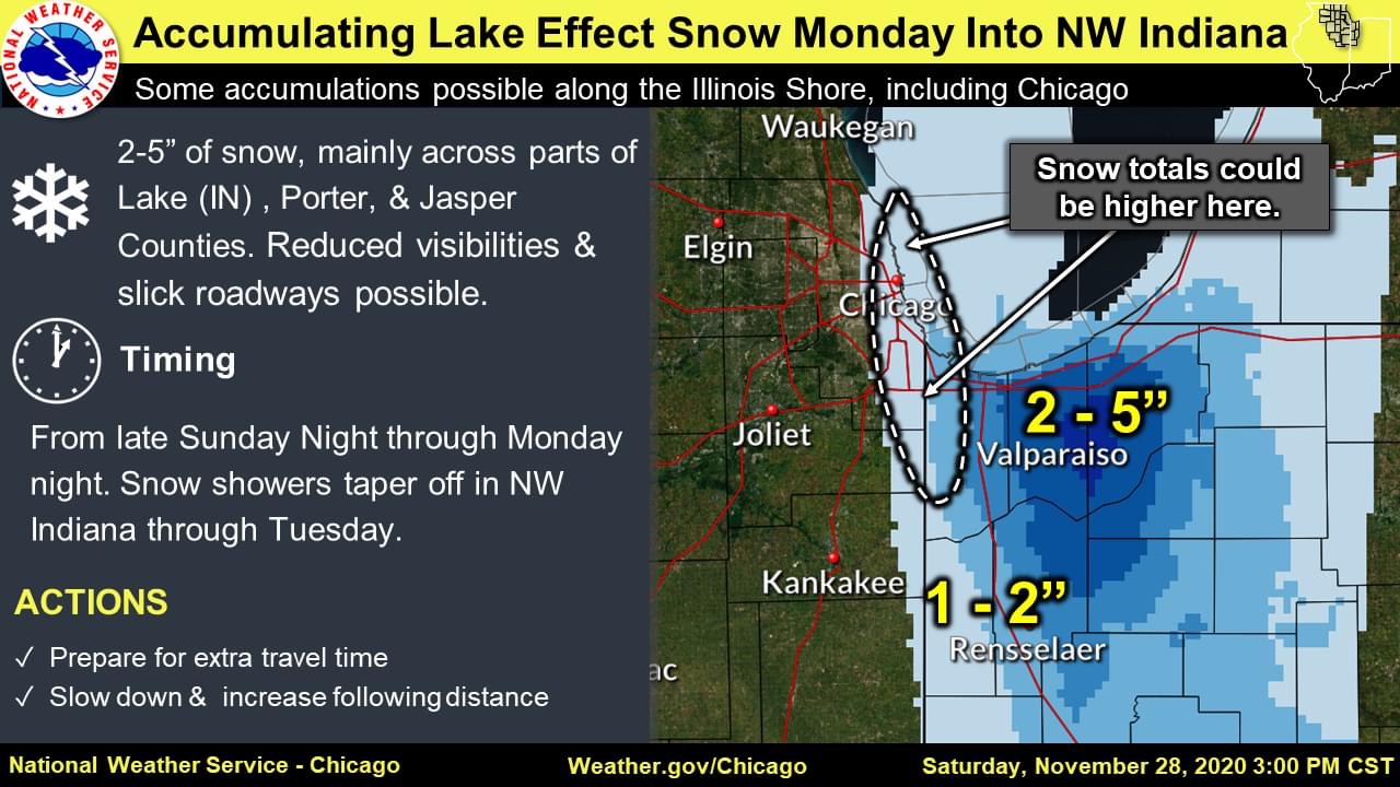
A period of accumulating lake effect snow is expected late Sunday night through Monday night, mainly across parts of northwest Indiana. With Porter County showing the highest totals in the lake effect snow belt. Reduced visibilities and slick roadways will be possible. Higher snow totals could occur into parts of Chicago, but confidence on that remains low.

With NW winds, it was never going to happen.