The National Weather Service has released additional details on two tornadoes that crossed into Lake County during Tuesday’s historic derecho, including an EF-1 through Munster and an EF-2 through St. John into western Crown Point.
While the tornadoes caused significant localized damage, it’s important to understand the bigger picture: the derecho itself produced a much larger footprint of destructive winds across Northwest Indiana, with winds around 100 mph in portions of the Region. Which in reality are equal to a tornado or hurricane.
MUNSTER — EF-1 TORNADO
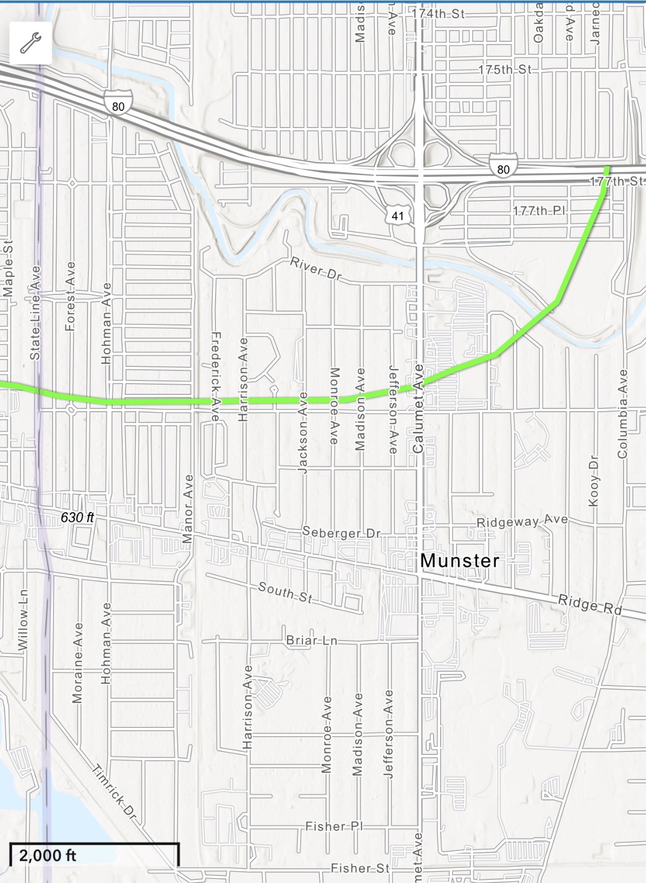
The tornado that eventually moved into Munster developed near Orland Park and remained on the ground for 22.4 miles, reaching a maximum width of 300 yards — roughly three football fields — with estimated peak winds of 105 mph.
The tornado crossed the Bishop Ford Expressway and moved through Lansing, producing considerable tree damage before crossing the Indiana state line just north of Ridge Road.
It continued through Munster before turning north and dissipating shortly after crossing I-80, just east of Calumet Avenue.
Based on the damage pattern and the NWS tornado track, we firmly believe much of the more widespread damage across central and eastern Munster came from the derecho’s straight-line winds rather than the tornado itself.
The video posted in the comments was taken in Munster approximately 2.1 miles from the actual tornado path. We’re sharing it to demonstrate just how intense the non-tornadic portion of this storm was.
ST. JOHN — TORNADO UPGRADED TO EF-2
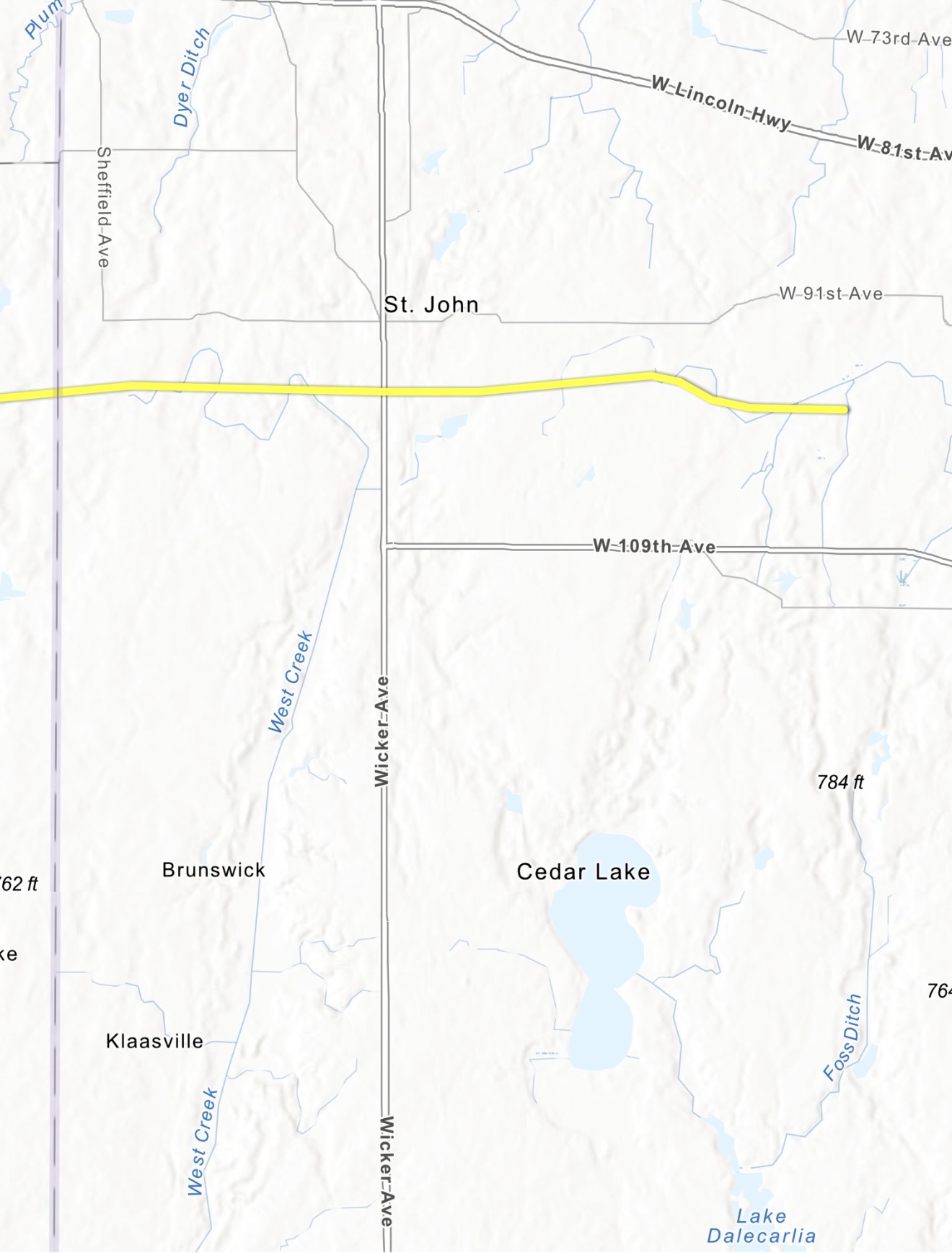
The National Weather Service has upgraded the tornado that tracked from Monee, Illinois, through St. John and toward western Crown Point to an EF-2 with estimated peak winds of 115 mph.
The tornado touched down around 10:43 a.m. Tuesday near Monee and remained on the ground for approximately 19 minutes, traveling 25.75 miles before ending around 11:02 a.m., approximately two miles west-northwest of Crown Point.
It also reached a maximum width of approximately 300 yards.
The tornado crossed the state line and continued nearly due east through the St. John area, generally between 91st and 109th avenues, before continuing toward western Crown Point.
No injuries or fatalities have been reported from this tornado.
SO WHAT EXACTLY HAPPENED TUESDAY?
Here’s a simple way to visualize how a derecho producing widespread straight-line winds can also generate tornadoes.
Imagine you’re in a swimming pool or bathtub. Put your open hand underwater and quickly sweep it through the water.
Your hand creates a powerful surge of water moving forward, but behind and along the edges of that movement, you’ll often see smaller swirls and eddies develop.
Tuesday’s storm worked somewhat similarly, just on an enormously larger and much more complicated atmospheric scale.
The derecho produced a massive surge of destructive straight-line winds. Along portions of the leading edge, areas of rotation developed and tightened enough to produce tornadoes embedded within the larger windstorm.
In simple terms: one enormous push of destructive wind, with smaller areas of rotation spinning up along the way.
And that distinction matters when looking at Tuesday’s damage.
The tornadoes were destructive, but their paths were only a few hundred yards wide. The derecho’s destructive wind field covered a huge portion of Lake County and Northwest Indiana simultaneously. In many locations, straight-line winds around 100 mph were comparable to — or even stronger than — winds within the confirmed tornadoes.
That’s also why damage surveys following an event like this can be complicated. Tornado damage is embedded within an enormous surrounding area already damaged by extreme straight-line winds.
ABOUT THE RADAR IMAGE:
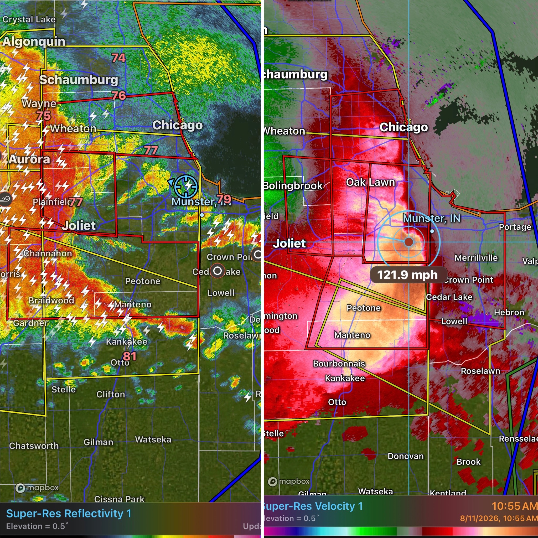
The image on the left shows conventional precipitation radar as the storm approached the state line, with the red boxes representing tornado warnings. The image on the right shows wind velocity, including winds reaching approximately 121 mph above ground level.
Notice how the strongest wind signatures spread across much of Lake County. This wasn’t simply a couple of tornadoes moving through the Region.
Northwest Indiana took a direct hit from an extremely powerful derecho, with tornadoes embedded along its leading edge.
The National Weather Service says survey information remains preliminary as damage assessments continue.